History of Kenmore Square
by Bill Tarkulich
Table of Contents
Notes to the 2021 Update
From a Tidal Basin to a Gateway
South
Side of Commonwealth Avenue
Peerless Motor Car Building, 660 Beacon Street (1910)
Cities Service Oil Company Building, 660 Beacon Street (1940)
Sheraton (Shelton) Apartment Hotel (1923)
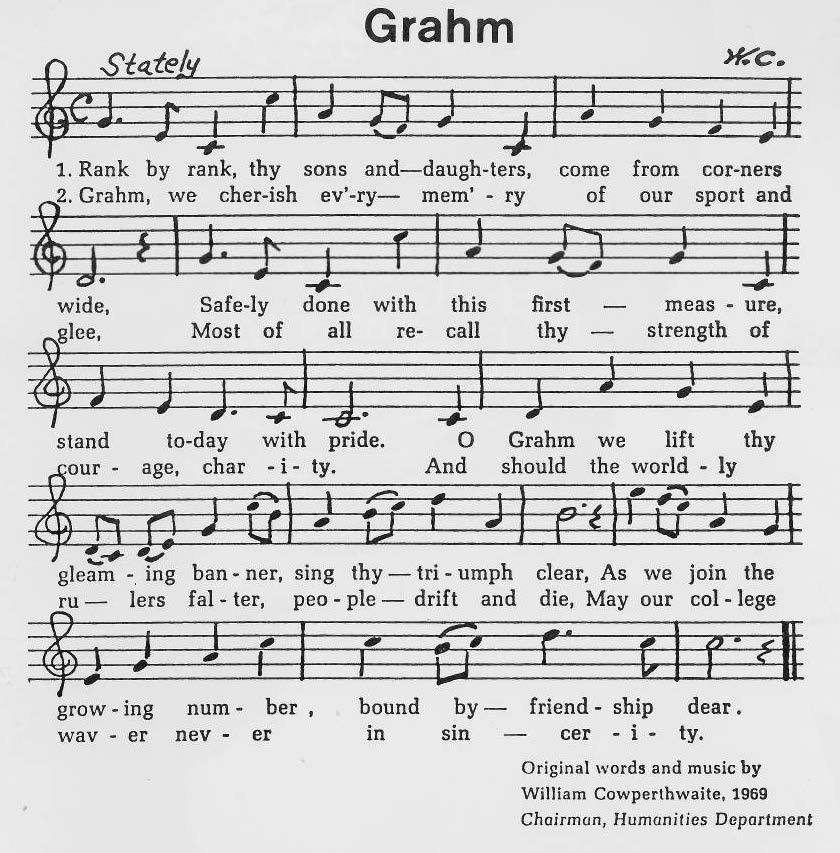
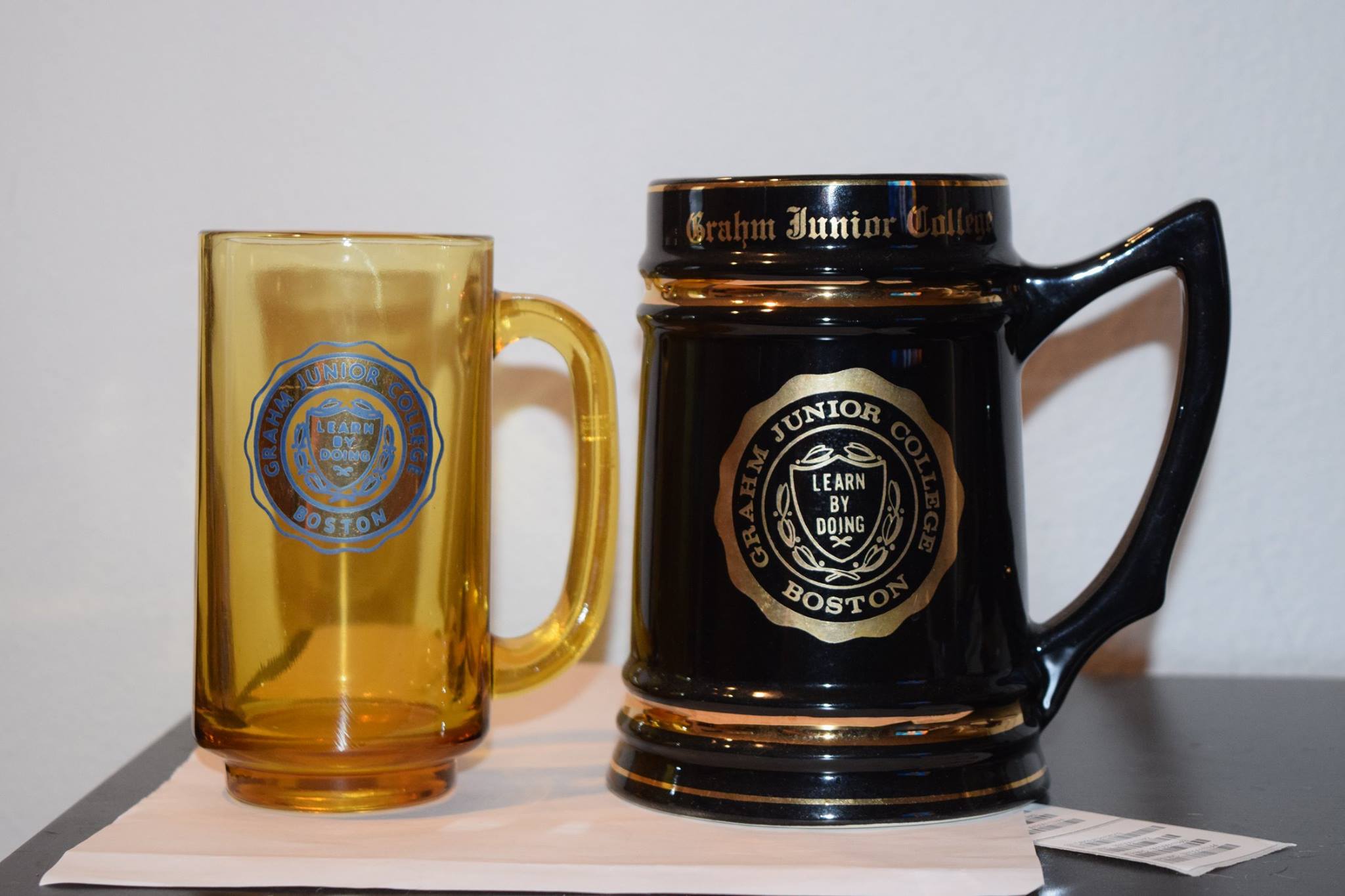
Grahm
Junior College (successor to the Cambridge School)
Rathskeller (528 Commonwealth)
1990’s – The tidal basin slowly turns
Part
IV: New Development & the Future
Fenway Center (Under Construction)
How Kenmore Square Got Its Name
Appendices
APPENDIX I – A Concise Timeline
APPENDIX III – Development of the Back Bay
Notes to the 2021 Update
While the intent of this piece is primarily focused on documenting much of the pre-internet history of Kenmore Square, some interesting developments occurred recently worth noting. I have also extended my research to include the original design of Commonwealth Avenue, the Bowker Overpass and Kenmore Square's relationship with the "Emerald Necklace".
Preface
Bill Tarkulich, July, 2013
Part I - Growth
PART I: Growth
From a Tidal Basin
to a Gateway
In the early 19th century the area
now known as Kenmore Square was called Sewell's Point, located at the edge of a
tidal basin called the Back Bay. It was connected to the rest of Boston by
a narrow road that ran atop a Mill Dam running along the Charles River.[i]
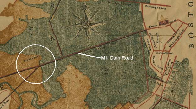
Figure 1 Milldam Plan, 1814. The future Kenmore Square is circled[ii]
The aim of the Mill Dam was to use the tides of the Charles River to power 100 mills for industrial purposes. Additionally, the dam would serve as a toll road. In the end, Dearborn's plan was not realized (only three mills signed up) and a much simpler Mill Dam was built by 1821. Eventually, this project failed in part because of sewage and wastewater build-up in the tidal basins. This build-up caused unpleasant smells that drifted all over the city. As a result, in May 1855, the Back Bay began to be filled in and developed. “[iii]
The Back Bay was filled in by the late 19th century along with the Charles River dam. Three busy roads converged at place called “Three Roads Junction”, which was previously known as Sewell's point. The former “Mill Dam Road” became Beacon Street, Brookline Avenue and Brighton Avenue west of this junction (renamed as a continuation of Commonwealth Avenue).
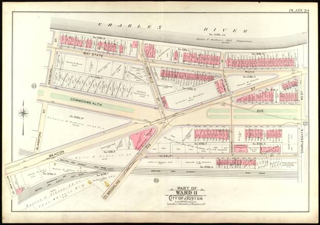
Figure 2 Governor Square, 1912 Ward Map
By 1870, three roads merged from
the west, Western Ave (Brookline Ave), Beacon St. and Brighton Avenue
(Commonwealth Ave.) at a point called “Three Roads”. The first buildings shown on an 1895 ward
map include the Belvoir (corner of Beacon and Raleigh (Kenmore) streets, the row
houses/offices (510-524 Commonwealth) and the Westgate, (corner of Beacon and
Deerfield). Also 13-57 Bay State
Road had been constructed. The Buckminster Hotel, on the corner of Beacon and
Brookline streets was the first hotel to open in 1899.
For the most part, the square
always has been a commercial center, with residences wrapping it to the north
(Bay State Road) and east (Commonwealth, Beacon and Newbury.) Other hotels came rapidly after the
Buckminster; Wadsworth (1902), Hotel Kenmore (1915), Sheraton (1917) and the
Myles Standish (1926). Outside of
the Square were the Somerset (1899) and Braemore (1917).
The Braemore, Kenmore and Wadsworth Hotels were jointly managed.[vi]
From the beginning, the square was filled with a “quiet
elegance”; Stately brownstone residence-offices, upscale hotels, restaurants,
clubs doctor’s practices and professional offices. It was host to major baseball teams, and
central to the Longwood medical area visitors.
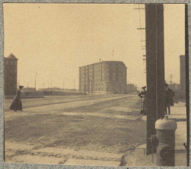
Figure 3 Hotel Buckminster, Governor Square, circa 1900, Courtesy of the Boston Public Library, Leslie Jones Collection.
The area soon grew with businesses
and residences, and it's location with high traffic made it attractive to the
hotel industry. After all, it was called a gateway into Boston for those coming
from Brookline, Allston and the western suburbs. As early as 1926, “Kenmore
Square” was the name informally being used to refer to the area.[vii]
With growth
came challenges. In 1926, five
neighborhood associations joined forces to drive civic issues such as
elimination of begging and peddling, loitering, police protection, highway and
sidewalk repair, snow, ash and garbage removal.”[viii]
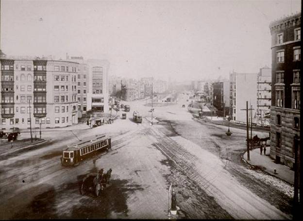
Figure 4 Governor Square, 1915. Courtesy of the Boston
Public Library, Leslie Jones Collection
The Boston Elevated Railway
There were three schemes presented for
the subway to reach its western terminus at Kenmore Square. “One scheme contemplates an open incline
in the embankment, beginning near Massachusetts Avenue and reaching the surface
at Charlesgate East, from which point the cars would pass on a bridge, or
similar structure, across Stony Brook [Ed. Today’s Muddy river] and connect with
the existing tracks on Beacon street, near its junction with Bay State road.”
“The second plan contemplates continuing the tunnel under the waters of Charlesgate and brining the tracks to the surface by an open incline, in the centre of Commonwealth avenue, between Charlesgate West and Kenmore street."
“The third plan also contemplates continuing the tunnel under the waters of Charlesgate and thence along the line of Beacon Street to a point just west of Raleigh Street, brining the tracks to the surface by an open incline in the central part of the broad open space formed by the junction of Commonwealth Avenue and Beacon Street. Under this latter plan the westerly end of the incline would be a short distance east of the line of Deerfield Street.” [xi]
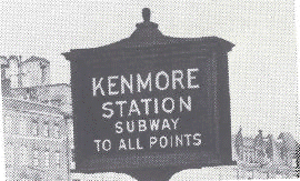
In the final design, the subway emerged from the underground east of Kenmore square, in the Commonwealth Avenue mall, making its first above-ground stop Kenmore Street. The subway emerged on what was referred to as an “incline.” It was customary to name subway and trolley stations after intersecting roads. The stop became known as “Kenmore Station.”
Almost as soon as the subway line
was completed, complaints about traffic in the square began. In 1927, it was reported, “Automobiles,
pouring in from Beacon Street and Commonwealth Avenue where the thoroughfares
merge at Kenmore Station were held for 6 ½ minutes.”[xii]
As an attempt to mitigate these
issues, a plan was presented to widen Commonwealth Avenue from Charlesgate East
to Massachusetts Avenue (opposite the Hotel Somerset and the Harvard Club).
A bridge between Charlesgate East and West, running from the Fens to Storrow
Drive was also planned.
Traffic problems continued to
increase during the 20’s. The square
was considered by some to be the busiest in the city, with rush hour jams that
had become intolerable to residents, commuters and police. Everyone except the
“El” agreed that the conflicts between trolley and automobile were by far the
largest contributor to congestion.
Ideas such as one-side-of-street parking, widening Commonwealth Ave,
routing light traffic onto Bay State Road and making Charlesgate west into a two
way road were considered.[xiii]
To address the congestion, in 1926 the
state legislature passed an act allowing for extension of the Boylston street
subway, presumably by tunnel under Governor Square. Mayor Malcolm Nichols continued to
pressure the Elevated to take action.
The Elevated refused, saying this was a problem of “motor congestion, not
trolley congestion”.[xiv]
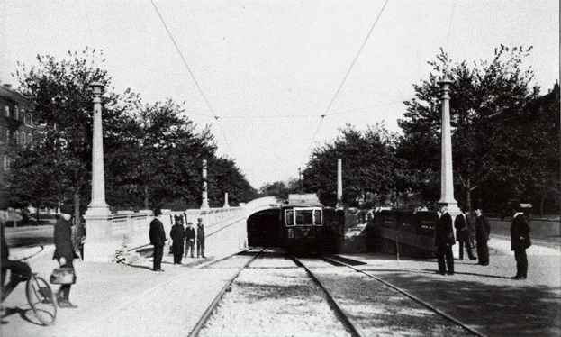
Figure 5 Original Kenmore Station Incline, Circa 1914
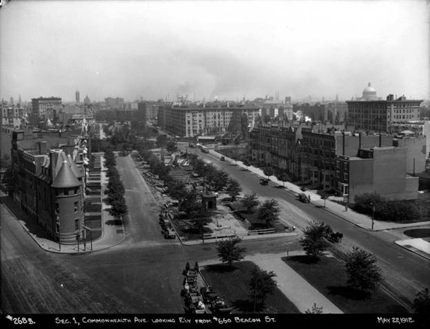
Figure 6 1912 - The massive Somerset is in the far distance. Neither the Braemore or the Kenmore have been constructed. Notice the Subway Incline is under construction and the Commonwealth mall extended to the center of the square. Courtesy of the Boston Public Library, Leslie Jones Collection
By early 1928, city officials had
had enough of an unresponsive Boston Elevated Railway. Management of the El suggested that the
problem could be solved by “subwaying [sic] street vehicles.” While the city owned all underground
routes, many wanted take control and put entire El into public ownership. [xv] In 1930, more than 40,000
automobiles were making their way through the square every day.[xvi]
It wasn’t until Mayor James Michael
Curley was reelected that pressure was put on the Legislature to move on the
issue. Based on a bill that
Curley had originally submitted in 1925, the city agreed to pay any operating
losses the El might suffer as result of the Governor Square extension.
In August of 1930, the first of the
steel beams for the Kenmore underground station were delivered. By the end of 1932, the Kenmore subway
station began operation. A
business group brought forth a request that the city change the name of the
square from Governor to Kenmore since it was already part of the local
vernacular. On December 31, 1932 Mayor Curley signed
a bill changing the name to “Kenmore Square.”
Eventually the assets of the El were transferred to an entirely public
entity, the Metropolitan Transit Authority in 1947.
Figure 7 Remnants from the original
subway incline
The bridge connecting the Fens to the newly
opened Storrow Drive over the Muddy River between Charlesgate East and
West was opened in 1951. While traffic necessitated this interconnection, it severed the square’s link to
the elegant strip which progressed from the Public Garden.
The bridge was not only a physical separation, but became a social
separation as well. [xvii]
The center of the square, which
earlier had included a center mall, was replaced with a bus terminal. There have been three incarnations of the
terminal, a wooden one in the 40’s, one of concrete in 1968 and steel and glass
shelter in the 2010’s. The later was
the first to have a direct connection to the subway below. Until that point the only means of subway
entrance and egress was from opposite sides of the square.
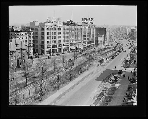
Figure 8 Kenmore Square, 1930, Courtesy of the
Boston Public Library, Leslie Jones Collection
South Side of Commonwealth Avenue
Figure 9 500-548 Commonwealth Ave, South Side, 1970’s
The block of buildings on the south side of Commonwealth Avenue, stretching from Kenmore Street halfway to Brookline Avenue (516 to 532) was constructed circa 1900, at roughly the same time as the Buckminster Hotel. The block was used as medical offices. With public transportation at its doorsteps, it became an attractive location for medical practices. Several of these building had residences in the upper floors.
In the early years, these buildings had small grass “lawns” in front. In 1936, a new concept fence, the “chain-link” was adopted by the owners to protect the lawns. The fence was marketed not only as safe, but “neighbor friendly” due to its visual transparency.
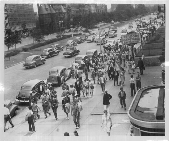
Figure 10 South side of Commonwealth Avenue, 1936. The lawns with fencing can be seen on the right, Courtesy of the Boston Public Library, Leslie Jones Collection
The Brookline Avenue end of the block was filled commercial buildings. These businesses included a long-standing Auto School, Walton’s Lunch, automotive retail space, National Shawmut Bank (1925), a Chocolatier and the “Haberdasher and Hatter” store (1932). Kenmore Pharmacy, which opened in 1932 to service the medical community, was originally located in this section (538).
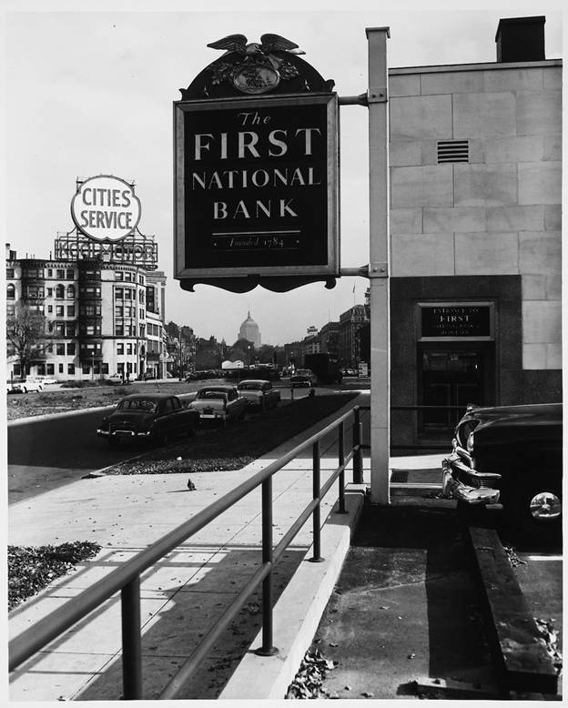
Figure 11 In 1941 the bank touted a new "Drive Through" service, Courtesy of the Boston Public Library, Leslie Jones Collection
After World War II, physicians, and other businesses followed their customers to the suburbs. These tenants were replaced by small technology companies, proprietary schools, liquor stores, cocktail lounges, Brigham’s, (ice cream shop) White Tower, a salon and a credit counselor.
Newbury Street (West)
West Newbury Street is a little-known abutter to the square. It is connected to the square by Kenmore Street. Unlike its northerly counterpart, Bay State Road, Newbury today contains but a few residences. Before the adjacent Massachusetts Turnpike, “Mass Pike” was constructed, a row of houses stretched from Mass. Ave to a little west of Kenmore St. These homes were built in 1893.[xviii] Further down the street, a large building contained an auto sales business in the 1920s, later a cigar manufacturer and an equipment distributor, Perkins Sales. The Wadsworth Hotel and several other apartment buildings east of Kenmore Street are all that remain today.
The Kenmore Hotel was originally planned to be placed at the corner of Kenmore and (West) Newbury Streets, opposite the Hotel Wadsworth. For reasons unknown, that plan was scuttled and the hotel was built on the diagonal corner of Commonwealth and Kenmore St. In 1924, attempts were made to construct a parking garage on that same site. This never happened. (Figure 14)
In 1965, the extension of the Mass Pike alongside the railroad right-of-way was constructed. The parallel row of houses on the south side of Newbury St. was demolished to accommodate the new highway. (Figure 13)
.
Figure 12 Newbury Street, 1937 – Newbury Street looking east towards Massachusetts Avenue. Wadsworth Hotel is on the left, Boston & Maine railway right of way on the right. These homes were demolished to make way for the Mass. Turnpike in the 1965, Courtesy of the Boston Public Library, Leslie Jones Collection
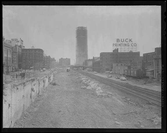
Figure 13 the Massachusetts Turnpike extension under construction. Kenmore Square is off-camera to the left. The Hotel Wadsworth is visible in the middle left. Newbury Street (left) hangs to the parallel edge of the canyon. The Prudential tower is under construction[xix] Photo taken from Brookline Ave. Circa 1965. , Courtesy of the Boston Public Library, Leslie Jones Collection
Auto Row
From 1900 to 1940 a mile-long
stretch of Commonwealth, from Kenmore Square westward was known as “Auto Row”[xx]. Over 100 “auto machine”
dealers, stores and service businesses were in operation. Peerless Auto was the first to lease a
new, large showroom for a regional office.
The neon signs, Cities Service (CITGO), White Fuel and Gulf were erected
in the 30’s. The post-war period
signaled a move to the suburbs by growing families. The auto-related businesses on
Commonwealth Avenue followed their customers.
In time, the majority of the “auto row” came into ownership by Boston University
as they drove to integrate their campus.
[i] http://www.bahistory.org/HistoryMillDam.html
[iii] “Courtesy of the Massachusetts Historical Society”, 2013
[v][v] Matt Hasson, 2013
[vi] Hotel and Travel Department Information Bureau, Sunday Herald Traveler, Jun 24, 1923
[vii] Boston Globe, 3/30/26
[viii] Consider Forming New Organization, Boston Daily Globe, Mar 30, 1926
[ix] Three Sections are Completed, Boston Daily Globe, Mar 14, 1913
[x] Boylston-St Subway Complete, Boston Daily Globe, Sep 27, 1914
[xi] The Riverbank Subway Entrance, Boston Herald, Nov 12, 1907
[xii] Governor-Sq Traffic Delays Continue”, Boston Daily Globe, Oct 22, 1927
[xiii] Working to Solve Traffic Problems in Governor Sq., Boston Daily Globe, Jun 16, 1926
[xiv] Mayor Again Urges Subway Extension, Boston Daily Globe, Oct. 20, 1926
[xv] Foss For Public Ownership of the “L”, Daily Boston Globe, Feb 10, 1928
[xvi] Governor Sq sees 40,000 Cars a Day, Mar 6, 1930
[xvii] Embankment Road Opens Both Lanes to Traffic Today, Boston Globe, Jun 15, 1951
[xviii] Real Estate Transactions, West Newbury Street Operations, Boston Herald, Jul 21 1893
[xix] Courtesy of the Boston Public Library, Leslie Jones Collection.
[xx] http://www.bu.edu/today/2011/a-trip-down-automobile-row/